shape shape shape

Hello, I am Julia Wakaba

header App dots

Skills

Explore my skills.

  • Geospatial & EO
  • Programming
  • DevOps
GeoPandas

ArcGIS Pro

Rasterio

QGIS

Sentinel

Snap

Sentinel

Google Earth Engine

Docker

Python

GeoDjango

Django/GeoDjango

Node.js

Node.js

PostGIS

Postgresql

Docker

Docker

Mentorship

Podman

Storytelling

Github Actions

Storytelling

Azure

Storytelling

Kubernetes

about dots

About Me

I’m an Earth Observation and Digital Earth Specialist with a deep passion for transforming spatial data into solutions that create real-world impact. Over the past five years, I’ve worked across environmental monitoring, agriculture, fintech integrations, and GIS automation, building geospatial tools that are practical, meaningful, and genuinely useful.

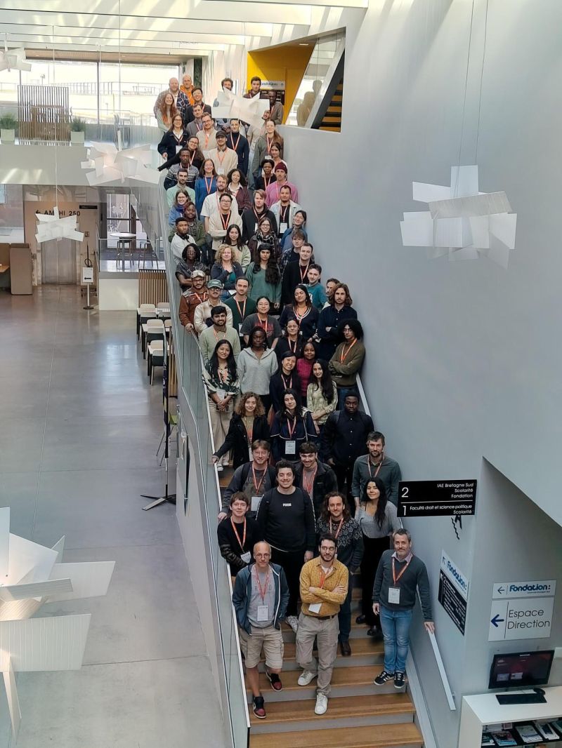
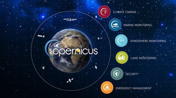
I am currently pursuing the Copernicus Master in Digital Earth at the Paris Lodron University in Salzburg, Austria and Université Bretagne Sud in France.

My technical toolkit includes Python, Django, PostGIS, ArcGIS, QGIS, Docker, CI/CD, and modern geospatial application development. I enjoy taking complex geospatial challenges and translating them into clear, actionable insights, creating solutions that truly help people.

Outside of work, I enjoy travelling (though mostly the part where I finally arrive), volunteering the geospatial knowledge I’ve gained over the years, and exploring new and emerging geospatial technologies.

Discover

Professional Journey

My education and professional work experience.

Education

Copernicus Master in Digital Earth

September 2026 - 2027
Naxa Logo

Department of Geoinformatics (Z_GIS)
University of South Brittany - Vannes, France

Second Year: Specialization - GeoData Science

Oct 2025 - Present
Naxa Logo

Department of Geoinformatics (Z_GIS)
Paris-Lodron University - Salzburg, Austria

First Year: Geoinformatics and Earth Observation

Experience

Systems Developer - Consultant

January 2025 - September 2025
  • - Developed Python/ArcPy scripts to convert and migrate geospatial data from PostgreSQL/PostGIS to Oracle Spatial (SDO_GEOMETRY)
  • - Built ETL workflows handling geometry transformation, CRS alignment, schema mapping, and data validation across databases
  • - Optimized spatial data transfer using SQL, spatial indexing, and bulk operations for large datasets
  • - Published enterprise feature services and web maps for operational use
  • - Designed and deployed ArcGIS Field Maps for mobile data collection, synchronization, and field-based validation
  • - Created Esri Dashboards to monitor spatial data quality, field activity, and operational KPIs
  • - Attended stakeholder meetings, gathered requirements, incorporated feedback, and presented geospatial insights to support project alignment

Software Engineer - Consultant

December 2024 - October 2025
  • - Designed and implemented a scalable RESTful backend using Node.js (TypeScript) and Express, supporting national-scale livestock registration, tracking, and ownership workflows. Link to the application
  • - Developed PostgreSQL/PostGIS data models for animals, farmers, premises, breeds, ownership history, and geographic hierarchies (county, sub-county, ward).
  • - Integrated role-based access control (RBAC) to enforce permissions for administrators, veterinarians, field officers, and system user
  • - Developed bulk data ingestion and synchronization pipelines to handle millions of farmer and livestock records from external APIs
  • - Optimized database performance using indexes, query tuning, and spatial indexing for large-scale datasets
  • - Configured CI/CD pipelines (GitHub Actions) for automated build, test, and deployment workflows
  • - Worked closely with GIS teams, frontend developers, and government stakeholders to translate operational requirements into backend services
  • - Contributed to documentation and knowledge transfer to support long-term system maintainability

GIS Backend Engineer - Full Time

August 2019 - November 2024
  • - Develop and maintain NaiParQ's GIS-enhanced parking management solution and vehicle tracking project using Django Rest Framework
  • - Orchestrate the transformation of a traditional vehicle tracking platform into a geospatially-aware solution, optimizing fleet routes by integrating live traffic and road data, leading to a 30% decrease in travel time
  • - Lead a team of 5 developers to deliver MVP projects, ensuring alignment with stakeholders' needs and diverse perspectives
  • - Configure analytics tools (e.g., Google Analytics, Mixpanel) to monitor customer interaction across websites, mobile apps, and social media platforms.
  • - Leverage insights from analytics to optimize product placement and enhance system performance by 30%

Geospatial and Data Science Trainer - Part Time

January 2019 - 2025
  • - Orchestrate location intelligence training sessions, enabling participants to proficiently perform suitability analysis using diverse datasets within the QGIS desktop application. Equip trainees with cartography skills that empower them to craft maps showcasing optimal locations based on specified parameters
  • - Spearhead GIS web mapping workshops, guiding attendees to harness the capabilities of GeoDjango (a Python framework), Angular, and Leaflet. Empower trainees to create interactive maps displaying utility and dam locations across the country, leveraging dynamic web technologies
  • - Deliver comprehensive training on ArcGIS desktop, equipping participants to seamlessly source, import, and analyze data as layers within the software. Train participants to manipulate spatial information, culminating in the creation of informative maps. The training also includes knowledge of various satellites and their applications, enriching participants' understanding of geospatial technology

Academic Work

Welcome to the CDE Master's Programme Collection! This is where theory met reality. Indeed, I solved problems and honed my skills.
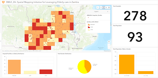
  • Semester 1
blog
Digital Earth
  • GEE
  • Sentinel Scripts

Spatial-Temporal Analysis of Lake Nakuru's Rapid Water Level Increase 2017–2024

View Github
blog
Advanced Cartography
  • QGIS
  • Canva

SDG 2: Spatial Relationship Between Political Stability & undernourishment

blog
Spatial Thinking
  • Next.js
  • Cesium

Visualization of the Copernicus Products

View Project